Maxar Partners with Anduril to Power U.S. Army’s Mixed-Reality Combat System
Maxar Partners with Anduril to Power U.S. Army’s Mixed-Reality Combat System
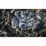
Maxar's near real-time 3D representation of the operational terrain will be integrated into the command-and-control system being built by Anduril Industries for the SBMC-A program
WESTMINSTER, Colo.--(BUSINESS WIRE)--Maxar Intelligence, the leading provider of secure, precise geospatial insights, today announced a strategic partnership with Anduril to supply the foundational geospatial intelligence that will underpin a next-generation mixed-reality command-and-control (C2) system that Anduril Industries is developing for the U.S. Army.
The C2 system will power the Soldier-Borne Mission Command Architecture (SBMC-A) program, which will provide U.S. warfighters with a futuristic mixed-reality capability that overlays real-time battlefield intelligence directly into a soldier’s field of view. Advanced headsets will display digital information on top of their real-world view during live combat missions and training. This system requires detailed, accurate and up-to-date 3D maps to serve as the spatial foundation for intelligence flowing into the system.
SBMC-A isn’t a set of goggles—it’s a software, network, and integration layer that turns every soldier into a node in the C2 network. Legacy mission command systems built around maps and radios can’t keep up with the speed and complexity of modern battlefields. By integrating Maxar’s geospatial intelligence into Anduril’s Lattice AI-powered software, SBMC-A gives soldiers accurate, real-time awareness of terrain and threats—turning data into actionable insight that strengthens survivability and accelerates decision making in contested environments.
“This partnership positions Maxar at the heart of the Army's most advanced combat systems,” said Susanne Hake, General Manager, U.S. Government, Maxar Intelligence. “As military operations become increasingly integrated and automated, Maxar’s software-enabled geospatial intelligence capabilities become vital to maintaining America's military advantage, protecting our warfighters and delivering results on the battlefield.”
“We’re excited to partner with Maxar to bring their best-in-class geospatial intelligence to the tactical edge,” said Tom Keane, SVP of Engineering at Anduril. “This collaboration demonstrates the openness of the Lattice platform and the power of the Lattice Data Mesh to fuse Maxar’s precision terrain data with other mission-critical sources in real time. Our strategy for SBMC is to bring together the best technology from across industry—and Maxar is a key part of that mission to increase warfighter effectiveness and lethality.”
Maxar will deliver this foundation through a software-enabled solution that Anduril integrates into its Lattice software, leveraging Maxar’s 3D operational terrain—a high-fidelity digital representation of the physical world. Maxar’s automated 3D production software will ensure terrain data is refreshed within hours of collecting new satellite images, keeping the 3D foundation aligned with ground truth in live combat operations and training missions.
Through this contract, Maxar and Anduril will deliver a working prototype of the 3D foundation to the U.S. Army, with a focus on 14 initial locations of interest. The partners will also advance the solution toward full operational capability. The partnership builds on Maxar's existing support of the Army's One World Terrain program, for which the company has been providing 3D mapping data since 2019.
Maxar’s 3D foundation offers several key advantages that are critical for next-gen combat systems:
- High-resolution imagery at global scale: Maxar’s 3D global terrain data is delivered at 50 cm resolution—detailed enough to identify individual vehicles and structures—covering over 100 million square kilometers globally, or 95% of the highest areas of interest.
- Highly accurate data: Maxar’s 3D data maintains 3-meter accuracy in all dimensions, enabling it to serve as a trusted geospatial reference for all real-time data that flows through the platform.
- Rapid updates: Maxar’s satellites can revisit the same location on Earth up to 15 times per day, and its automated processing software turns that imagery into updated 3D terrain within hours to ensure that soldiers have the most current battlefield information.
About Maxar Intelligence
Maxar Intelligence is a leading provider of secure, precise geospatial insights. Operating the most advanced commercial Earth observation constellation on orbit, we use the power of very high-resolution satellite imagery and software technology to deliver mission success on Earth and in space. Our secure, AI-powered products and services deliver ground truth in near real-time to keep nations safe, improve navigation, protect our planet, speed up disaster response and more. To learn more, visit www.maxar.com.
About Anduril Industries
Anduril Industries is a defense technology company with a mission to transform U.S. and allied military capabilities with advanced technology. By bringing the expertise, technology, and business model of the 21st century’s most innovative companies to the defense industry, Anduril is changing how military systems are designed, built and sold. Anduril’s family of systems is powered by Lattice, an AI software platform that turns thousands of data streams into a real-time, 3D command and control center. As the world enters an era of strategic competition, Anduril is committed to bringing cutting-edge AI, computer vision, sensor fusion, and networking technology to the military in months, not years. For more information, visit www.anduril.com.
Contacts
Media Contact:
Tomi Maxted
Maxar Intelligence
tomi.maxted@maxar.com